OpenCurb
Enhance your maps with on-street parking regulations!
What is OpenCurb?
OpenCurb™ is reinventing the infrastructure layer for curbside management, services and mobility. It started out in 2014 after a late night out in Manhattan when its founder, Clarence Bowen, had been circling blocks for minutes just to find a parking space to grab a slice of pizza. There, he noticed that although he could not legally park in front of the pizzeria, he could technically "stand" his vehicle to get curbside deliveries (a foreign concept in 2014). It is his vision to make curbside (on- and off-street parking) management efficient via software and hardware solutions.
Currently, OpenCurb includes a comprehensive data feed of on-street parking regulations in New York City (first city rollout) for maps which can be used in in-vehicle navigation, personal mobile and curbside deliverly logistics systems. Data is delivered in
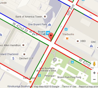
GeoJSON format where each feature is a geometric representation
of parking regulations (see NYC parking map demo and example parking map images below). A line or curb segment, bounded by signposts, indicates whether or not a given vehicle type (Passenger, Commercial, Truck, or Taxi) can perform a given action (Stop, Stand, or Park) during a given time frame. Run helper form below for data feed output examples.
Basic features are free to use for public consumers. For municipalities, enterprises, fleets and brick-and-mortar businesses looking to incorporate curbside delivery solutions, please reach out to sales@opencurb.com.


How does it work?
A signpost can be modelled as a set of regulations that specify one or more vehicle types, actions, directions, and time frames. The regulations of a signpost extend up until the next signpost or end of curb (whichever comes first). OpenCurb parses the regulations, generating line segments that connect these signposts/curb-ends based upon the values of the attributes mentioned above. Line segments are drawn parallel to the curb to ensure that they overlay nicely on base maps including those based on OpenStreetMap (works best), Microsoft Bing Maps, Google Maps, MapQuest, etc. See documentation for more details. Use the helper form to get an idea of the input and output to expect.Why should I use it?
Use cases are plentiful. As a mapmaker in the business of NYC parking, you should spend less time parsing NYC parking regulations, and more time on your business. If you're in the business of NYC parking tickets, legal street parking, and violations OpenCurb is a must. If you're in the business of off-street garage-parking you may want to supplement your maps with on-street regulations. If you run a valet parking app, you may choose to provide your employees with the option of locating, and parking at nearby open curbs. Perhaps you are a navigation dashboard mapmaker looking to go beyond routing, by providing passenger and commercial drivers parking, standing, and stopping functionality. Whatever your use case is, OpenCurb can certainly help give you an edge in the competition. Also, it's free...yes, FREE! Registration and API keys are also not required. Get started on building your query strings today.Helper Form
Use this form to get an idea of the input and output to expect.